This walk takes place in the Flatts Lane Country Park which comprises around 26.5 acres of hilly woodland, farmland and moorland between the villages of Normanby, Ormesby and Nunthorpe on the southern edge of Middlesbrough. The site has a long industrial past which includes ironstone mining and brickworks but was transformed into its current usage as a recreational area in 1994. The current Flatts Lane road was only metalled (given a hard surface) by the local authorities in 1926. Prior to this it was just a cobbled track which crossed the Eston hills and linked the neighbouring villages of Nunthorpe and Ormesby, market town of Guisborough and the ports of Middlesbrough and South Bank and was used by monks, farmers and market traders. Some of the old cobbles are still visible in places. Incidently, “Flatts” in the name of Flatts Lane refers to blocks of arable land and not, as it often thought, to any ownership by a person by the surname “Flatt”.
 The entrance of the old bridleway is on the right-hand side of the modern Flatts Lane road, just past the A174 (‘The Parkway’) bridge coming from the Norman Conquest. Upon entering the footpath the first section of woodland, on the left, is known as High Cow Howl. This was originally a larger piece of woodland which stretched northwards along Flatts Lane. Before the A174 was built in the 1970s a small farm track ran westward along its current route through Cross Wood before turning south down to West Farm. Thin sections of Cross Wood still exist alongside the the A174 (the northern part runs behind the houses on Bexley Drive). The section of woodland alongside Flatts Lane north of this track was called Low Cow Howl and it now the site of the former Eston County Modern School, and later South Park Sixth Form College, playing fields.
 Continuing along the old Flatts Lane bridleway High Cow Howl ends and a large field is now visible through the trees on the left. Originally owned by a Mr Gildroy of East Farm (the site of which now houses the Woodlands Road estate opposite the Norman Conquest pub) and known locally (for some unknown reason) as “Leatherbelly” this was home, between the wars, to the Normanby Magnesite football team, made up mostly of employees of the nearby brickworks. They achieved some success during this period winning the Teesside League in 1925 and 1928 and the Ellis Cup (a competition which involved many amateur teams in the local area) on five occasions between 1923 and 1935. Attempts to join the Northern League were thwarted by the meagre facilities at the ground (of which not a trace can be found today) and the outbreak of the Second World War led to the demise of the club due to it loosing many of its players through military service. The club managed to produce a number of players who later went on to appear in the Football League including the right-back George Goldsmith who made 172 appearance for Hull City between 1928 and 1933 before brief careers with Spurs and Bolton, Ron Blake (Middlesbrough and Wigan Borough) and the goalkeeper Des Fawcett who played over 300 games for six different Football League clubs (including Darlington and York City) between 1926 and 1939.
At the western side of this field, seperating it from the neighbouring one is a thin strip of trees known as The Stripe. According to local historian Spencer Hardwick in his booklet entitled “Normanby Remembered” there is, hidden amongst the trees surrounding the sports field and close to the line of electricty pylons which pass overhead, a small and overgrown pond which was originally created by a bomb crater during a German bombing raid in 1940. In my attempts to locate this pond I left the footpath and clambered up into The Stripe. The ground was quite boggy and thick with creepers but I managed to fight my way through a thorny bush and across a small beck into a gap which had been cut through the trees so that a pylon could be erected. There was no trace of the bomb crater pond but before I made my way back to the footpath I paused to look into the empty field to the west. It was then that I spotted a lone fox making its way slowly across to the trees on the field’s southern edge. I entered the field to try and get a better look (and possibily a photo) and carefully scrambled over the low ridges which covered the field, the frost covered grass cracking gently as I did so, but the fox was unfortunately lost from sight.
 Flatts Lane runs along the northern edge of the field in which I had seen the fox then turns turns southwards for a short distance, passing once more beneath the line of pylons, before joining the footpath that was created along the route of the old Cleveland Railway line which linked the Normanby and Ormesby brickworks. Approximately 50 metres before the track turns south if you look on the left-hand side of the path you may well notice some small pellets beneath the hedgerow. These will belong to the Barn Owl that oftens perches there during the winter. Alas there was no sign of it during my visit though. Bullfinches are also regularly spotted in this area.
At the crossroads there are a number of paths that can be taken. Heading east will take you back towards the main Flatts Lane road passing through Woodcock Wood on the left-hand side of the footpath and Spring Wood on the right. Hidden within Spring Wood is Springwood Bungalow which seems to date from the early 1920s. At one time it was home to the manager of the brickworks, Freddie Brooks who also used to manage the Normanby Magnesite football team mentioned earlier. In 1927 the woodland surrounding the bungalow was briefly home to a nightingale, a rare visitor to these parts. A large crowd of locals regularly kept vigils throughout the night in order to hear its beautiful song and a great deal of interest was generated by the visitor with an article even appearing in the local Evening Gazette newspaper. The woods just to the north of the bungalow also housed the sewage filter tank for the brickworks at one point.
 I chose this eastern route in order to continue my search for the crater pond as I wished to explore the trees on the southern edge of the old sports ground. Just after a second line of pylons crossed the path some small steps led down to the open avenue in the trees through which the pylons ran. A number of small tracks ran into the woods on the far side and I chose one at random and wandered through the trees looking for signs of the elusive pond. And I somehow managed to stumble across it halfway along the field’s length and about 10 metres into the trees from its edge. It was roughly circular in shape and the green algae on its surface had been frozen into place by the ice that had formed overnight. Five bombs were dropped in total during the bombing raid which created the pond but the other four craters have been lost in the undergrowth, I certainly couldn’t find any of them The target of the bombs would have been the Normanby brickworks whose glowing coal-fired kilns would have been clearly visible during night-time.
 Just to the west of the crater pond a small spring rises up from the earth and soon forms a small beck by the name of Middle Gill. This beck snakes its way through The Stripe (I had stepped into it earlier whilst searching unsuccessfully for the pond) then passes beneath the A174 and underneath Bexley Drive, Guildford Road and Buckingham Drive before rising to the surface again in the woodland between Aldwych Close and Kensington Avenue. I grew up on Kensington Avenue (in fact my parents still live in the same house) and often used to play in the beck at either my own house or friends houses along the street as it passed through a sort of concrete channel and made its way through various back gardens. My parents covered it up a few years ago but as far as I know the beck still flows beneath and continues on through the woods behind Hollywalk Close and past the site of the former Normanby Hall. At the junction of Cricket Lane and Ormesby Road it meets Spencer Beck (which rises just near the site of the former Ormesby Brickworks) and continues onward alongside the Thorntree and Brambles Farm estates, through Skippers Lane Industrial Estate before joining the River Tees close to Normanby Wharf.
") Between the crossroads and the bungalow a number of small footpaths make their way southwards up the gorse and bracken covered Round Hill. The slope of this hill was one of the locations used for sledging, or poly-bagging (using on an old plastic sack, often one that used to contain fertilizer from ICI) if a sledge was out of the budget in my pocket money, in my youth along with the
Between the crossroads and the bungalow a number of small footpaths make their way southwards up the gorse and bracken covered Round Hill. The slope of this hill was one of the locations used for sledging, or poly-bagging (using on an old plastic sack, often one that used to contain fertilizer from ICI) if a sledge was out of the budget in my pocket money, in my youth along with the  field next to the old Flatts Lane college and the hill at the top of Flatts Lane Country Park visitor centre site. At the top of Round Hill the footpaths contain onwards until they meet up with the Crabtree Walk bridleway which runs just about parallel with the old railway path at the bottom of the hill.
 The old Flatts Lane path continues south from the earlier crossroads climbing up through the woodland and past some hills housing old Ironstone workings with the huge gouges, holes and craters from this mining still clearly visible all over the landscape. In the late 19th century an small off-shoot from the main Cleveland Railway ran alongside the footpath, up Round Hill and
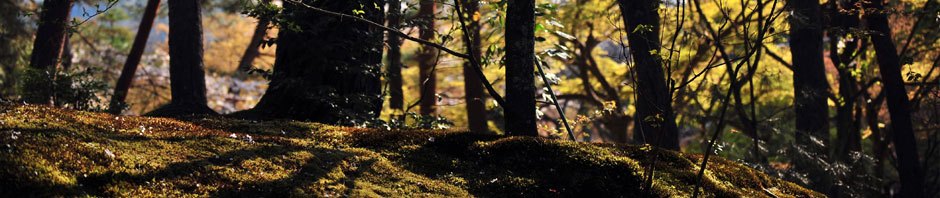
  crossed Crabtree Walk to another set of Ironstone workings to the south (now the location of a farmer’s field). I decided to explore the forest between Crabtree Walk and the Old Railway Walk as the early morning sunlight was causing some beautiful effects with light and shadow as it shone through the trees to the south.
Despite the earlish time of day (it was around 9am) there were still quite a lot of people, like myself, out and about in the park – walking their dog, jogging or just partaking in a morning walk to enjoy the scenery. There were plenty of other wildlife within the woods as well. Apart from the fox I had seen earlier an abundance of birds could be heard, and occasionally seen as they flew overhead or flitted from branch to branch. Apart from the usual songbirds the instantly recognisable noisy chatter of the magpie was one of the most common sounds during my walk. Whilst I had been exploring the old ironstone mines next to Round Hill I had heard rustling in the nearby bushes and glimpsed what appeared to be a white flash from the tail of a roe deer as it ran off. Now, as I headed back down to the old railway footpath I heard more rustling, louder this time, and was thrilled to see three female roe deer appear on the hillside in front of me. I kept as motionless and as quiet as possible whilst preparing my camera so as to hopefully grab a photo of them. However, they still managed to spot me and ran off a short distance before stopping once more. I fired off a few photos and luckily  managed to get a decent one of two of the deer before they fled into the forest. Just after they had gone I met a guy coming down from where they had been with his small dog running along in front of him. He asked if I’d seen them and I replied that I had managed to get some photos before they disappeared. I mentioned that I had earlier seen a fox and he told me he walked in the park regularly but had never seen a fox up there and that it was probably the smell of his dog scaring them off. A number of other visitors also mentioned to me that they had seen the deer, or other wildife when they saw me wandering around with my camera around my neck. One woman walking her dog told me she had seen a woodpecker a few days before (Green Woodpeckers are regular visitors) and also what looked like a cuckoo but I would think it is far too early for that. The first cuckoos don’t usually appear until the spring when Long-tailed Tits can also be seen building their nests in the park.

 Once back on the old railway footpath I wanted to try and find some evidence of the farm, West Farm, which used to exist just off the path up until the 1970s. Looking at old maps of the area it appeared the the farm was just
  _to the west of a small pond and just before the footpath branched offtowards the subway leading to Spencerbeck and Guildford Road. I found the pond easily and could see what appeared to be a ridge of earthworks on its western edge. Upon searching the trees and undergrowth between these earthworks and the footpath I managed to find some old moss-covered brickwork which was
  _obviously the remains of the former farmhouse. Birds to look out for along the railway footpath are the Grasshopper Warbler which is often seen in the scrubland to the north of the path, Chiffchaffs, Lesser Whitethroats, Jays and if you’re lucking you may even see some Woodcock “roding” at dusk.
 Heading further west along the railway footpath I soon came to the location of the former Ormesby Brickworks, now just a large empty field. Prior to the building of the brickworks this site also housed the Ormesby ironstone mines. These mines opened in the mid 1860s and were originally owned by the company Swan, Coates and Co. and were used to provide iron ore for their iron
  works at Cargo Fleet. In 1871 a row of four miners cottages were built close to the site as well as a Guibal fan house which was used to purge the air within the mine. The mined iron ore was transported along the Cleveland Railway directly to the blast furnaces at Cargo Fleet Iron Works. In 1879 the owners changed their name to the Cargo Fleet Iron Co. Ltd and the output from the mine increased to its maximum capacity two years later when almost 170,ooo tons of iron ore were extracted. An average of around 75,000 tons per year was mined during the 27 years the mine was operational until the supply was finally exhausted in January 1892 leading to its closure. Incidently Mr J.G Swan of Swan, Coates and Co. and who was also the managing director of the Cargo Fleet Iron Co. lived in Upsall Hall (which still exists,and is currently used as a facility for people with learning difficulties, on the main Guisborough road on the southern border of the Country Park) and also gives his name to Swans Corner between Nunthorpe and Ormesby Bank.
 Ten years later, in 1902, a brickworks owned by the Ormesby Metallic Brick Co. was built on the site but this company lasted only until 1913. Between 1913 and 1916 the brickworks operated under the ownership of J. Crossley & Sons, a well-known local builders merchants and brick supplier. In 1916 the site was bought by the Cleveland Magnesite and Refractory Co. who would
  go on to purchase the neighbouring Normanby brickworks two years later. The history of the Ormesby brickworks from this time onwards can be found in the section regarding the Normanby brickworks later on in this article. The buildings related to the brickworks were demolished in the mid 1970s and their foundations covered with soil removed during the construction of the A174 Parkway just to the north of the site. Landscaping and tree builiding to try and hide the scars of its industrial past was also carried out quite succesfully. In 1983 the 14 acre site was purchased by Cleveland County Council for recreational use and was linked to the neighbouring former Normanby brickworks site to create the current Flatts Lane Country Park. Today there is nothing to be seen on the field itself but in the trees to the south a large number of old bricks can be seen. Many of them still had the ‘Ormesby’ stamp, used to denote their place of origin, clearly visible upon them.

 At the far western end of the railway footpath a set of steps lead up towards Long Bank Farm and Ormesby but branching off to the south another footpath leads up to the continuation of Flatts Lane from where it joins Crabtree
  Walk. Flatts Lane continues on to the west for a short distance passing the covered Nunthorpe reservoir and the radio mast and exiting at the top of Ormesby Bank close to Swans Corner. I crossed over Flatts Lane and climbed up a set of steep steps to the top of High Godfalter Hill, a prominent local landmark with the bunch of beech trees upon its summit visible for miles
  around. The origin of its name is unclear but it may be linked to the fact that one of the footpaths to the top of the hill once formed part of a Monk’s Trod. At the summit a wooden bench marked with the inscription “In Loving Memory – Tom and Jean Potter” can be found. Fine views to the north over Normanby, Eston and down towards Hartlepool; east towards Eston Nab; southwest towards
  Nunthorpe; south towards the Cleveland Hills and southeast towards Roseberry Topping can also be enjoyed. During the summer the hill is a fine location for spotting butterflies and the winter months can bring the spectacle of a large magpie roost in the woodland to the north.
 I left the hill on the footpath leading SE towards the Great West Plantation before turning northwards along the former Union and Local Board District bridleway which originally ran from Upsall quarries, along Crabtree Walk then south to Upsall Hall and onwards to Nunthorpe. Upon joining Flatts Lane I turned east and continued down the track for a short distance before I
  heard what may well have been a sparrowhawk coming from the coniferous forest of the Great West Plantation at the southern end of the park. I went some way into the forest in order to try and find the source of the noise but was unable to do so. I then came to the junction of Flatts Lane and Crabtree Walk where I took a short detour down the hill before continuing along Crabtree Walk
  to just before it meets the modern Flatts Lane road which runs down to the A171 Middlesbrough – Guisborough road. Looking south from here the route of the main Cleveland Railway track can still be seen cutting through the trees of Dibdale Plantation. The railway was built in 1861 to link Normanby Jetty on the River Tees to Loftus via Guisborough. As it passed through Eston Hills numerous offshoots from the main track lead off to the various mines and brickworks dotted around the area. However, the section of track between Guisborough the Normanby brickworks was closed in 1873 after only 12 years of service.
 To the north a small pond can be seen and just behind it, separated by a fence and a small dam, is a rectangular pond containing a few duckboards which used to act as a reservoir for the brickworks. Just past this reservoir the track splits with the right-hand section leading along the main road to the top of the hill at the visitor centre field. The left-hand section, which I
  took, leads to the exercise area to the south of the visitor centre. Maps of the Normanby brickworks site showed a number of outbuilding, of unknown purpose, just to the left of this track and so I decided to see if I could find any signs of these hidden amongst the trees. It didn’t take me too long before I found numerous earth and vegetation covered brickwork remnants dotted about but they gave me no clues as to their original usage.
Upon reaching the visitor centre I found it open and so went in to use the toilet and to see if I could find out more information regarding the history of the site. Unfortunately there was no-one around inside and the exhibition hall was locked but there were a few leaflets on the local wildlife available. In the grounds surrounding the centre there are numerous facilities on offer. As well as the aforementioned exercise area there is also a bird-feeding station which often attracts species such as the Nuthatch, Willow Tit, Siskin and Goldfinch, a small hide from which to observe the feeding birds, a recently opened playground and a woodland trail. There is also a large sloping grassy field above the centre which is popular for sledging during the winter or for picnics and ball-games during the summer. Recently a mobile cafe selling hot food and drinks has been available in the centre’s car park just off the main road.
 The site of the visitor centre and it surroundings used to house the Normanby brickworks. The Normanby Brick & Tile Company opened in 1883 and employed many local people, including my grandfather at one stage. In 1918 the site was purchased by the Cleveland Magnesite and Refractory Company who had also bought the neighbouring brickworks at Ormesby two years previously. This purchase doubled the companys production of silica bricks to around 120,000 per week. Up until 1939 the two brickworks also manfactured roof tiles and chimney pots but afterwards the production line was switched to refractory bricks for industrial purposes such as blast furnaces. In 1953 the Cleveland Magnesite and Refractory Co. was bought out by Steetley but in 1971 the works at both Ormesby and Normanby closed down and the latter site soon became derelict before finally being demolished in 1979. Planning permission te re-use the site as a public open space was then granted and work on creating the Flatts Lane Woodland Country Park was begun soon afterwards, finally opening in 1994. I can remember playing up there in the late 1970s when I was a young boy and seeing the ruins and the thousands of red bricks laying around all over the place, a few of which can still be found even today hidden away in the undergrowth.
The Flatts Lane Country Park is well worth a visit. You can spend many hours exploring the park searching for signs of its industrial past, enjoying the beautiful and varied scenery that now exists on the site or looking for for the many different kinds of wildlife that make their home there.
Maps


Nice to read about the area I grew up in. My parents bought the old brickworks house hidden in the woods of flatts lane they moved there when it was a derelict house in 1970 when I was 6 months old. I miss looking out the bay windows at the deer in the field at front our home .
Hi there,
Thanks for your comment. A former work colleague of mine used to live in that house as well. This would have been in the 90s or so. His name was Neil Hardwick.
That would be my brother.
i enjoyed reading through your walk which i found whilst looking for information on Normanby Brickworks. My research for this years Normanby Local History Group exhibition on Saturday the 9th of July. i am trying to compile a list of former employees and their stories about working there. i would like to use some extracts from your walk if i may. it would be even better if i could include something about your grandads time there a long with a photo of him.
best regards
sylvia.fairbrass
Hello
Pleased can you assist? We’ve found some old bricks in a building in our home town of Pocklington (East Riding of Yorks) with ‘J Hanks & Co. Pocklington’ stamped on the frogs, we think probably late-1800s. The only likely contender we can find is a James Hanks who was recorded in the 1891 Normanby census as a ‘Grocer and Brick manufacturer’ and just as a ‘Brick manufacturer’ in 1901.
He may have been connected with a John Nottingham (no relation) who lived in ‘Ormesby Cottage’, Ormesby, up to the 1871 census. John N is listed as a brick LAYER, but may have had something to do with the Ormesby Brick & Tile Works as several of his near-neighbours are listed as ‘Labourers at Brick Yard’.
John N then moved to Hull – still listed as a brick LAYER – but seems to have been linked to our small brickyard at Pocklington, maybe as owner/manager.
Please would you have any knowledge of either or both the James Hanks & John Nottingham; if either or both had any connections with the Normanby & Ormesby brickyards; and, especially, could the ‘Hanks & Co.’ bricks have been made at Normanby for transport by rail to Pocklington?
All help VERY gratefully received, TIA!
Hi John,
Thanks for your message, I will try to find out more about this for you. I’m a member of a local history group which may be able to supply some information. I will forward your message on to them.
Regards
Jeff
Hi Jeff
Many thanks for your help; much appreciated.
I thought it might assist if I attach a pikky of the recently-found ‘J Hanks & Co. Pocklington’ brick.
The 1879 Post Office Directory for Pocklington lists a ‘John Nottingham, Brickmaker’, while the 1889 Kelly’s Directory for Pock lists a ‘J Hanks & Co, Brickmakers, Burnby Lane’, the latter referring to quite a small brick and tile works on the outskirts of Pock, arguably far too small to meet the needs of our Market town.
Other Pock brickmakers are mentioned in several directories – but none of them seem to have lived in or near Pocklington, so we’re deducing that they may have been absentee owner/managers of the small brickyard. And with a John Nottingham (BrickLAYER from Ormesby), plus a James Hanks (BrickMAKER) from Normanby in the censuses, we feel there just has to be a link.
But whether Hanks bricks might have been made at the Pocklington works – or whether they were made at Normanby/Ormesby and transported by rail – is a mystery. I note that the shape of the Hanks brick frog isn’t the same as the Normanby/Ormesby brick frogs in your excellent article (the 4 corners are trimmed), but that may be a red herring.
Just to confuse the issue, along with the ‘Hanks’ bricks recently found in a building in Pock, there’s also a number of ‘Pomfret’ bricks. This raises a query as to whether they came from the brick & tile works to the north of Pontefract, almost alongside the railway. So were they shifted to Pock by rail? And if so, were the Hanks bricks similarly shifted by rail from the Normanby area, maybe as a contract let to James Hanks? Very confusing! 🙂
Thanks again Jeff and regards
John N
Hello John
J Hanks, Livens,and Hanks were in 1901 the North Eastern brick and tile works at South Bank. Be carefull there are at least 3 other brick works in South Bank. I copied the reference whilst researching Normanby brickworks, for my display as part of Normanby Local History Groups annual display on Saturday 9th July.
Reference Peter J. Davison’s book Brick Works of the North East Coast, published by Portcullis press 1986 in Middlesbrough reference library c666.737.
The South Bank brickworks were in decline at the time of Normanby opening in 1883, so its possible they moved the Pocklington area.
If you come accross any references to Normanby Brick and Tile Co. the Cleveland Magnesite Refectory Co. Ltd or Steetley who took them over and ran the works until closure in 1971 please pass them on i would be so greatful.